
Decatur topographic map
Click on the map to display elevation.
About this map
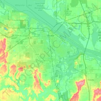
Name: Decatur topographic map, elevation, terrain.
Location: Decatur, Morgan County, Alabama, United States (34.48630 -87.10551 34.67087 -86.89729)
Average elevation: 604 ft
Minimum elevation: 489 ft
Maximum elevation: 873 ft
Morgan County trails, hiking, mountain biking, running and outdoor activities
Other topographic maps
Click on a map to view its topography, its elevation and its terrain.