Geolocate

Wallingford topographic map

Click on the map to display elevation.

About this map

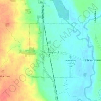
Name: Wallingford topographic map, elevation, terrain.

Location: Wallingford, Emmet County, Iowa, United States (43.31300 -94.80216 43.32757 -94.78221)

Average elevation: 1,302 ft

Minimum elevation: 1,237 ft

Maximum elevation: 1,421 ft

Emmet County trails, hiking, mountain biking, running and outdoor activities

Other topographic maps

Click on a map to view its topography, its elevation and its terrain.

Gridley

United States > Iowa > Emmet County

Average elevation: 1,270 ft

Gear up for your next adventure:

🧤Hiking Gloves - Protective gloves for rugged trails
🔦LED Headlamp - Bright and durable LED headlamp for night navigation
🕶️Glacier Sunglasses - Side shields to protect eyes from high-altitude snow glare
📱Solar Portable Charger - Solar power bank for charging devices off‑grid
⛑️Personal Locator Beacon - Safety beacon for emergencies

As an Amazon Associate, this site earns from qualifying purchases at no extra cost to you.