
Carmacks topographic map
Interactive map
Click on the map to display elevation.
About this map
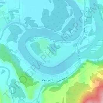
Name: Carmacks topographic map, elevation, terrain.
Location: Carmacks, Yukon, Canada (62.09205 -136.30248 62.10051 -136.27112)
Average elevation: 1,778 ft
Minimum elevation: 1,683 ft
Maximum elevation: 2,310 ft
Other topographic maps
Click on a map to view its topography, its elevation and its terrain.