Geolocate

Chappel topographic map

Click on the map to display elevation.

About this map

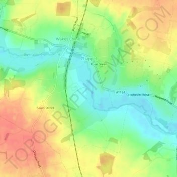
Name: Chappel topographic map, elevation, terrain.

Location: Chappel, Wakes Colne, Colchester, Essex, England, United Kingdom (51.90481 0.72894 51.92684 0.77777)

Average elevation: 144 ft

Minimum elevation: 52 ft

Maximum elevation: 240 ft

Other topographic maps

Click on a map to view its topography, its elevation and its terrain.

Berechurch

United Kingdom > England > Essex > Colchester

Average elevation: 92 ft

Layer-de-la-Haye

United Kingdom > England > Essex > Colchester

Average elevation: 95 ft

Wivenhoe Woods

United Kingdom > England > Essex > Colchester > Wivenhoe > Rowhedge

Average elevation: 59 ft

Boxted Cross

United Kingdom > England > Essex > Colchester > Boxted

Average elevation: 125 ft

Rowhedge

United Kingdom > England > Essex > Colchester

Average elevation: 66 ft

Birch Green

United Kingdom > England > Essex > Colchester

Average elevation: 115 ft

Messing

United Kingdom > England > Essex > Colchester

Average elevation: 148 ft

Salcott

United Kingdom > England > Essex > Colchester > Salcott

Average elevation: 46 ft

Dedham Vale

United Kingdom > England > Essex > Colchester > Dedham

Average elevation: 49 ft

Inworth

United Kingdom > England > Essex > Colchester

Average elevation: 151 ft

Gear up for your next adventure:

🧯Emergency Survival Kit - All‑in‑one survival essentials for the backcountry
🚪Portable Camp Chair - Foldable chair for comfort at camp
🧺Microfiber Travel Towels - Compact and fast-drying towels for trail use
🩹Survival Bandages - High‑quality bandages for emergencies
🖼️Topo Map Wall Art - Decorative topographic prints of famous peaks and regions

As an Amazon Associate, this site earns from qualifying purchases at no extra cost to you.