Geolocate

Darien topographic map

Click on the map to display elevation.

About this map

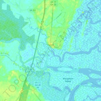
Name: Darien topographic map, elevation, terrain.

Location: Darien, McIntosh County, Georgia, 31305, United States (31.29313 -81.48468 31.43136 -81.37145)

Average elevation: 10 ft

Minimum elevation: -16 ft

Maximum elevation: 49 ft

McIntosh County trails, hiking, mountain biking, running and outdoor activities

Other topographic maps

Click on a map to view its topography, its elevation and its terrain.

Townsend

United States > Georgia > McIntosh County

Average elevation: 16 ft

Jones

United States > Georgia > McIntosh County

Average elevation: 13 ft

Shellman Bluff

United States > Georgia > McIntosh County

Average elevation: 16 ft

Gear up for your next adventure:

🔥Camping Stove - Portable stove for camping and backcountry cooking
🪶Multi‑Purpose Knife - Useful blade for camp and trail
🥩Freeze-Dried Meals - Nutritious and lightweight food for remote expeditions
💧Water Purification System - Clean water on the trail with reliable purifiers
Backpacking Tents - Weight-optimized shelters for multi-day topographic surveys

As an Amazon Associate, this site earns from qualifying purchases at no extra cost to you.