Geolocate

Townsend topographic map

Click on the map to display elevation.

About this map

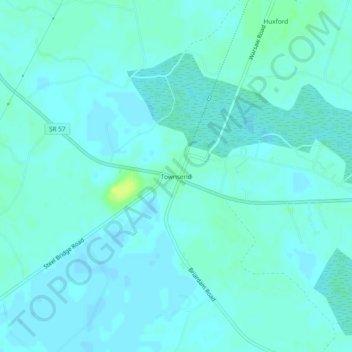
Name: Townsend topographic map, elevation, terrain.

Location: Townsend, McIntosh County, Georgia, United States (31.52174 -81.54339 31.56174 -81.50339)

Average elevation: 16 ft

Minimum elevation: 7 ft

Maximum elevation: 56 ft

McIntosh County trails, hiking, mountain biking, running and outdoor activities

Other topographic maps

Click on a map to view its topography, its elevation and its terrain.

Darien

United States > Georgia > McIntosh County

Average elevation: 10 ft

Gear up for your next adventure:

🔦LED Headlamp - Bright and durable LED headlamp for night navigation
🪑Portable Camp Table - Compact table for campsite meals
🧺Microfiber Travel Towels - Compact and fast-drying towels for trail use
🎒Trekking Poles - Sturdy poles for balance and stability on rough terrain
🧣Hiking Neck Gaiter - Multi‑use neck protection for outdoor weather

As an Amazon Associate, this site earns from qualifying purchases at no extra cost to you.