
Whitefish Bay topographic map
Click on the map to display elevation.
About this map
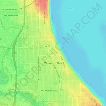
Name: Whitefish Bay topographic map, elevation, terrain.
Location: Whitefish Bay, Milwaukee County, Wisconsin, United States (43.09870 -87.91369 43.13484 -87.87507)
Average elevation: 623 ft
Minimum elevation: 561 ft
Maximum elevation: 735 ft
Milwaukee County trails, hiking, mountain biking, running and outdoor activities
Other topographic maps
Click on a map to view its topography, its elevation and its terrain.
Lakeshore State Park
United States > Wisconsin > Milwaukee County > Milwaukee
Average elevation: 591 ft