Geolocate

Albers topographic map

Click on the map to display elevation.

About this map

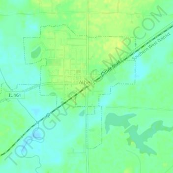
Name: Albers topographic map, elevation, terrain.

Location: Albers, Clinton County, Illinois, United States (38.53298 -89.63308 38.55238 -89.60267)

Average elevation: 430 ft

Minimum elevation: 404 ft

Maximum elevation: 459 ft

Clinton County trails, hiking, mountain biking, running and outdoor activities

Other topographic maps

Click on a map to view its topography, its elevation and its terrain.

Carlyle

United States > Illinois > Clinton County > Carlyle > Carlyle

Average elevation: 453 ft

Gear up for your next adventure:

🔥Plasma Lighters - Windproof lighters that work in any weather condition
🛶Inflatable Kayak - Portable kayak for rivers, lakes, and expeditions
🖼️Topo Map Wall Art - Decorative topographic prints of famous peaks and regions
📷Action Cameras - Rugged cameras to document your journeys across rugged terrain
🍳Camping Cook Set - Complete cookware for outdoor meals

As an Amazon Associate, this site earns from qualifying purchases at no extra cost to you.