
Las Cujas topographic map
Click on the map to display elevation.
About this map
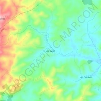
Name: Las Cujas topographic map, elevation, terrain.
Location: Las Cujas, Parroquia Convento, Chone, Manabí, Ecuador (-0.19089 -79.98740 -0.15089 -79.94740)
Average elevation: 928 ft
Minimum elevation: 702 ft
Maximum elevation: 1,371 ft
Other topographic maps
Click on a map to view its topography, its elevation and its terrain.