Geolocate

Mahimangad topographic map

Click on the map to display elevation.

About this map

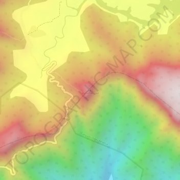
Name: Mahimangad topographic map, elevation, terrain.

Location: Mahimangad, Khed, Ratnagiri District, Maharashtra, India (17.71102 73.61030 17.71112 73.61040)

Average elevation: 2,110 ft

Minimum elevation: 771 ft

Maximum elevation: 3,176 ft

Other topographic maps

Click on a map to view its topography, its elevation and its terrain.

Khed

India > Maharashtra > Khed

Average elevation: 2,231 ft

Gear up for your next adventure:

GPS Sports Watch - GPS watch for running, hiking and training
🔦LED Headlamp - Bright and durable LED headlamp for night navigation
🧦Merino Wool Socks - Moisture-wicking, blister-preventing socks for long treks
Backpacking Tent - Lightweight and durable tent for multi‑day hikes
🎒Hydration Pack - Hands‑free water reservoir for long hikes

As an Amazon Associate, this site earns from qualifying purchases at no extra cost to you.