
Rinchi topographic map
Interactive map
Click on the map to display elevation.
About this map
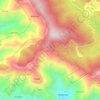
Name: Rinchi topographic map, elevation, terrain.
Location: Rinchi, Ranikhet, Almora District, Uttarakhand, 263134, India (29.58953 79.31228 29.62953 79.35228)
Average elevation: 5,476 ft
Minimum elevation: 4,026 ft
Maximum elevation: 6,562 ft
Other topographic maps
Click on a map to view its topography, its elevation and its terrain.
Majkhali
India > Uttarakhand > Ranikhet
Majkhali, Ranikhet, Almora District, Uttarakhand, 263652, India
Average elevation: 5,453 ft
Billekh
India > Uttarakhand > Ranikhet
Billekh, Ranikhet, Almora District, Uttarakhand, India
Average elevation: 4,892 ft
Kalakhet
India > Uttarakhand > Ranikhet
Kalakhet, Ranikhet, Almora, Uttarakhand, 263663, India
Average elevation: 5,289 ft