Geolocate

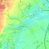
Fischbek topographic map

Click on the map to display elevation.

About this map

Name: Fischbek topographic map, elevation, terrain.

Location: Fischbek, Elmenhorst, Bargteheide-Land, Kreis Stormarn, Schleswig-Holstein, 23869, Germany (53.74413 10.26659 53.78413 10.30659)

Average elevation: 121 ft

Minimum elevation: 30 ft

Maximum elevation: 203 ft

Other topographic maps

Click on a map to view its topography, its elevation and its terrain.

Ammersbek

Germany > Schleswig-Holstein > Kreis Stormarn

Average elevation: 118 ft

Bargteheide

Germany > Schleswig-Holstein > Kreis Stormarn

Average elevation: 138 ft

Heilshoop

Germany > Schleswig-Holstein > Kreis Stormarn

Average elevation: 92 ft

Glinde

Germany > Schleswig-Holstein > Kreis Stormarn

Average elevation: 108 ft

Gear up for your next adventure:

🧥Men's Rain Shells - Premium waterproof and breathable jackets for mountain weather
🛌Ultralight Sleeping Bags - Compact down bags for cold nights in the wilderness
🩳Quick‑Dry Hiking Shorts - Comfortable and quick‑dry shorts for summer hiking
🌡️Portable Weather Meter - Track weather conditions on the trail
🧭Map Reading Tools - Tools and kits for map navigation

As an Amazon Associate, this site earns from qualifying purchases at no extra cost to you.