Geolocate

Altona topographic map

Click on the map to display elevation.

About this map

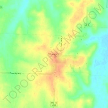
Name: Altona topographic map, elevation, terrain.

Location: Altona, Bates County, Missouri, United States (38.37974 -94.25495 38.41974 -94.21495)

Average elevation: 853 ft

Minimum elevation: 787 ft

Maximum elevation: 915 ft

Bates County trails, hiking, mountain biking, running and outdoor activities

Other topographic maps

Click on a map to view its topography, its elevation and its terrain.

Amsterdam

United States > Missouri > Bates County

Average elevation: 896 ft

Rich Hill

United States > Missouri > Bates County

Average elevation: 801 ft

Adrian

United States > Missouri > Bates County

Average elevation: 860 ft

Adrian

United States > Missouri > Bates County

Average elevation: 860 ft

Amoret

United States > Missouri > Bates County

Average elevation: 840 ft

Amsterdam

United States > Missouri > Bates County

Average elevation: 896 ft

Gear up for your next adventure:

🎒Waterproof Dry Bags - Keep your electronics and maps dry inside your pack
🚁Photography Drones - Capture stunning aerial views of landforms and topography
🦶Hiking Gaiters - Keep debris and water out of your boots
🥘Titanium Cookware - Durable, featherlight pots and pans for backpacking
🏥Hiking First Aid Kits - Comprehensive medical kits for remote trail injuries

As an Amazon Associate, this site earns from qualifying purchases at no extra cost to you.