Geolocate

Volnoye topographic map

Click on the map to display elevation.

About this map
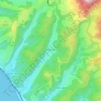
Name: Volnoye topographic map, elevation, terrain.

Location: Volnoye, Tuapsinsky District, Krasnodar Krai, Southern Federal District, 352812, Russia (44.06899 39.10231 44.09232 39.11836)

Average elevation: 354 ft

Minimum elevation: -3 ft

Maximum elevation: 1,106 ft

Other topographic maps

Click on a map to view its topography, its elevation and its terrain.

Dzhubga

Russia > Krasnodar Krai > Tuapsinsky District

Average elevation: 256 ft

Gear up for your next adventure:

🧢Sun Protection Hats - Wide-brimmed and UPF-rated hats for high-altitude sun safety
📷Action Camera - Capture your outdoor adventures in HD
🪶Multi‑Purpose Knife - Useful blade for camp and trail
📌Outdoor GPS Map App - Apps and devices for digital topographic navigation
🩳Quick‑Dry Hiking Shorts - Comfortable and quick‑dry shorts for summer hiking

As an Amazon Associate, this site earns from qualifying purchases at no extra cost to you.