Geolocate

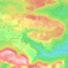
83600 topographic map

Click on the map to display elevation.

About this map

Name: 83600 topographic map, elevation, terrain.

Location: 83600, Bagnols-en-Forêt, Draguignan, Var, Provence-Alpes-Côte d'Azur, France métropolitaine, France (43.50764 6.64038 43.56431 6.86340)

Average elevation: 646 ft

Minimum elevation: 23 ft

Maximum elevation: 1,926 ft

Other topographic maps

Click on a map to view its topography, its elevation and its terrain.
Gear up for your next adventure:

🪑Ultralight Camp Chairs - Portable seating for resting after a long day of mapping
🚁Photography Drones - Capture stunning aerial views of landforms and topography
🛶Inflatable Kayak - Portable kayak for rivers, lakes, and expeditions
🥾Men's Hiking Boots - Durable, waterproof footwear for rugged terrain and steep inclines
👓Polarized Sunglasses - Outdoor sunglasses for glare reduction

As an Amazon Associate, this site earns from qualifying purchases at no extra cost to you.