Geolocate

Valère topographic map

Click on the map to display elevation.

About this map
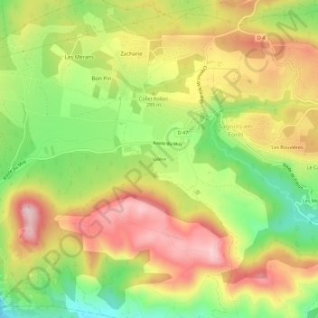
Name: Valère topographic map, elevation, terrain.

Location: Valère, Bagnols-en-Forêt, Draguignan, Var, Provence-Alpes-Côte d'Azur, France métropolitaine, 83600, France (43.51396 6.66488 43.55396 6.70488)

Average elevation: 892 ft

Minimum elevation: 377 ft

Maximum elevation: 1,388 ft

Other topographic maps

Click on a map to view its topography, its elevation and its terrain.

Gear up for your next adventure:

🧦Merino Wool Socks - Moisture-wicking, blister-preventing socks for long treks
🚗GPS Dash Cams - Record your scenic drives through mountain passes and canyons
🪶Wildlife Field Guides - Learn animal tracking and species ID
📱Heavy-Duty Phone Cases - Drop-proof and waterproof protection for outdoor navigation
🛡️Bear Spray Outdoor - Protection in bear country hikes

As an Amazon Associate, this site earns from qualifying purchases at no extra cost to you.