Geolocate

Hallbergmoos topographic map

Click on the map to display elevation.

About this map

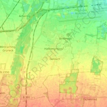
Name: Hallbergmoos topographic map, elevation, terrain.

Location: Hallbergmoos, Landkreis Freising, Bavaria, 85399, Germany (48.26952 11.68389 48.35863 11.78163)

Average elevation: 1,509 ft

Minimum elevation: 1,440 ft

Maximum elevation: 1,572 ft

Other topographic maps

Click on a map to view its topography, its elevation and its terrain.

Troll

Germany > Bavaria > Landkreis Freising > Moosburg > Moos

Average elevation: 1,394 ft

Seeberg

Germany > Bavaria > Landkreis Freising > Haag an der Amper

Average elevation: 1,545 ft

Mariabrunn

Germany > Bavaria > Landkreis Freising > Birkeneck

Average elevation: 1,486 ft

Dietersheim

Germany > Bavaria > Landkreis Freising

Average elevation: 1,545 ft

Günzenhausen

Germany > Bavaria > Landkreis Freising

Average elevation: 1,565 ft

Spörerau

Germany > Bavaria > Landkreis Freising > Wang

Average elevation: 1,345 ft

Gear up for your next adventure:

🎒Hydration Pack - Hands‑free water reservoir for long hikes
📻Weather Alert Radios - Stay informed of storm risks while off-the-grid
🧥Men's Rain Shells - Premium waterproof and breathable jackets for mountain weather
🧭Pro Hiking Compasses - High-accuracy liquid-filled compasses for topographic orientation
🥾Women's Hiking Boots - Top-rated trail boots with ankle support and superior grip

As an Amazon Associate, this site earns from qualifying purchases at no extra cost to you.