
Make a donation
Gear up for your next adventure:
As an Amazon Associate, this site earns from qualifying purchases at no extra cost to you.
Decebal topographic map
Click on the map to display elevation.
Make a donation
Gear up for your next adventure:
As an Amazon Associate, this site earns from qualifying purchases at no extra cost to you.
About this map
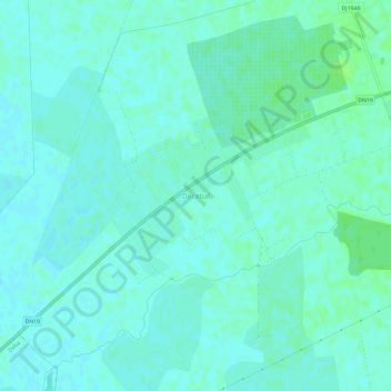
Name: Decebal topographic map, elevation, terrain.
Location: Decebal, Vetiș, Satu Mare, 447356, Romania (47.75017 22.74174 47.79017 22.78174)
Average elevation: 394 ft
Minimum elevation: 384 ft
Maximum elevation: 410 ft
Make a donation
Gear up for your next adventure:
As an Amazon Associate, this site earns from qualifying purchases at no extra cost to you.
Other topographic maps
Click on a map to view its topography, its elevation and its terrain.
Satu Mare
Satu Mare is situated in Satu Mare County, in northwest Romania, on the river Someș, 13 km (8.1 mi) from the border with Hungary and 27 km (17 mi) from the border with Ukraine. The city is located at an altitude of 126 m (413 ft) on the Lower Someș alluvial plain, spreading out from the Administrative Palace…
Average elevation: 407 ft
Make a donation
Gear up for your next adventure:
As an Amazon Associate, this site earns from qualifying purchases at no extra cost to you.
Make a donation
Gear up for your next adventure:
As an Amazon Associate, this site earns from qualifying purchases at no extra cost to you.
Satu Mare
Satu Mare is situated in Satu Mare County, in northwest Romania, on the river Someș, 13 km (8.1 mi) from the border with Hungary and 27 km (17 mi) from the border with Ukraine. The city is located at an altitude of 126 m (413 ft) on the Lower Someș alluvial plain, spreading out from the Administrative Palace…
Average elevation: 407 ft
Tarna Mare
Tarna Mare is situated in the Țara Oașului ethnocultural and historical region in the extreme north of Satu Mare County. It lies at an altitude of 168 m (551 ft), on the banks of the river Tarna Mare. The commune is located 54 km (34 mi) northeast of the county seat, Satu Mare, on the border with Ukraine.
Average elevation: 958 ft
Make a donation
Gear up for your next adventure:
As an Amazon Associate, this site earns from qualifying purchases at no extra cost to you.