
Cobden topographic map
Click on the map to display elevation.
About this map
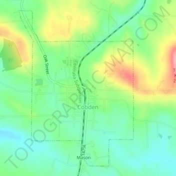
Name: Cobden topographic map, elevation, terrain.
Location: Cobden, Union County, Illinois, United States (37.52232 -89.26681 37.54626 -89.24460)
Average elevation: 627 ft
Minimum elevation: 492 ft
Maximum elevation: 856 ft
Union County trails, hiking, mountain biking, running and outdoor activities
Other topographic maps
Click on a map to view its topography, its elevation and its terrain.