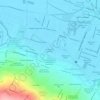
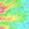
Ajusco topographic map
Click on the map to display elevation.
About this map
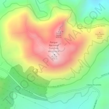
Name: Ajusco topographic map, elevation, terrain.
Location: Ajusco, Mexico City, 14715, Mexico (19.20723 -99.25814 19.20733 -99.25804)
Average elevation: 11,677 ft
Minimum elevation: 10,587 ft
Maximum elevation: 12,897 ft
Other topographic maps
Click on a map to view its topography, its elevation and its terrain.
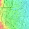
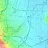
Coyoacán
Most of the borough located at 2,240 meters (7,350 ft) above sea level with little variation. Minor elevations are located in Ciudad Universitaria, San Francisco Culuacán and Santa Úrusula Coapa. The most important elevation is in the far south called the Cerro Zacatépetl which rises to 2,420 metres (7,940…
Average elevation: 7,470 ft

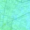

Mexico City
The majority of Mexican central and northern territories are located at high altitudes, and as such the highest elevations are found at the Trans-Mexican Volcanic Belt which crosses Mexico east to west: Pico de Orizaba (5,700 m or 18,701 ft), Popocatépetl (5,462 m or 17,920 ft) and Iztaccihuatl (5,286 m or…
Average elevation: 7,690 ft
Mexico City
Mexico City is the capital and largest city of Mexico, as well as the most populous city in North America. It is one of the most important cultural and financial centers in the world, and is classified as an Alpha world city according to the Globalization and World Cities Research Network (GaWC) 2024 ranking.…
Average elevation: 7,690 ft

Mexico City
The majority of Mexican central and northern territories are located at high altitudes, and as such the highest elevations are found at the Trans-Mexican Volcanic Belt which crosses Mexico east to west: Pico de Orizaba (5,700 m or 18,701 ft), Popocatépetl (5,462 m or 17,920 ft) and Iztaccihuatl (5,286 m or…
Average elevation: 7,690 ft
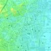
Xochimilco
Much of the borough's land is former lakebed. Its main elevations include Xochitepec and Tlacualleli mountains along with two volcanoes named Teutli and Tzompol. It contains two natural rivers called Santiago and Tepapantla along with the various canals, which is what is left of the lake. The elevated areas of…
Average elevation: 8,241 ft
Mexico City
Mexico City is the capital and largest city of Mexico, as well as the most populous city in North America. It is one of the most important cultural and financial centers in the world, and is classified as an Alpha world city according to the Globalization and World Cities Research Network (GaWC) 2024 ranking.…
Average elevation: 7,690 ft
Xochimilco
Much of the borough's land is former lakebed. Its main elevations include Xochitepec and Tlacualleli mountains along with two volcanoes named Teutli and Tzompol. It contains two natural rivers called Santiago and Tepapantla along with the various canals, which is what is left of the lake. The elevated areas of…
Average elevation: 8,245 ft
Mexico City
Mexico is crossed from north to south by two mountain ranges known as Sierra Madre Oriental and Sierra Madre Occidental, which are the extension of the Rocky Mountains from northern North America. From east to west at the center, the country is crossed by the Trans-Mexican Volcanic Belt also known as the…
Average elevation: 7,690 ft
Iztapalapa
The borough has an average elevation of 2,240 m (7,350 ft) asl and extends over firm land and what was former lake bed of Lake Texcoco. Some of the firm land is alluvial plain but most of it are elevations such as the Cerro de la Estrella (2,460 m or 8,070 ft asl), Peñón Viejo or Peñon del Marqués (2,400 m…
Average elevation: 7,375 ft
Álvaro Obregón
Mexico > Mexico City > Mexico City
Álvaro Obregón (Spanish pronunciation: [ˈalβaɾo oβɾeˈɣon]) is a borough (demarcación territorial) in Mexico City. It contains a large portion of the south-west part of Mexico City. It had a 2020 census population of 759,137 inhabitants and lies at an elevation of 2,319 m. above sea level.
Average elevation: 8,061 ft
Tlalpan
Much of the geology of the area formed when the Xitle volcano erupted in 100 CE, which created numerous caves and formed the basis of the volcanic soil that, 600 years later, makes the area's agriculture so productive. The borough has two types of soil: rocky in higher elevations and—in lower areas—less…
Average elevation: 9,295 ft
Mexico City
The majority of Mexican central and northern territories are located at high altitudes, and as such the highest elevations are found at the Trans-Mexican Volcanic Belt which crosses Mexico east to west: Pico de Orizaba (5,700 m or 18,701 ft), Popocatépetl (5,462 m or 17,920 ft) and Iztaccihuatl (5,286 m or…
Average elevation: 7,690 ft
Mexico City
The majority of Mexican central and northern territories are located at high altitudes, and as such the highest elevations are found at the Trans-Mexican Volcanic Belt which crosses Mexico east to west: Pico de Orizaba (5,700 m or 18,701 ft), Popocatépetl (5,462 m or 17,920 ft) and Iztaccihuatl (5,286 m or…
Average elevation: 7,690 ft
Iztapalapa
The borough has an average elevation of 2,240 m (7,350 ft) asl and extends over firm land and what was former lake bed of Lake Texcoco. Some of the firm land is alluvial plain but most of it are elevations such as the Cerro de la Estrella (2,460 m or 8,070 ft asl), Peñón Viejo or Peñon del Marqués (2,400 m…
Average elevation: 7,375 ft