
Frazee topographic map
Click on the map to display elevation.
About this map
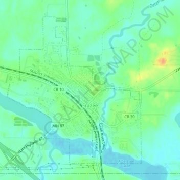
Name: Frazee topographic map, elevation, terrain.
Location: Frazee, Becker County, Minnesota, United States (46.71913 -95.71836 46.74109 -95.68893)
Average elevation: 1,391 ft
Minimum elevation: 1,352 ft
Maximum elevation: 1,470 ft
Becker County trails, hiking, mountain biking, running and outdoor activities
Other topographic maps
Click on a map to view its topography, its elevation and its terrain.
Detroit Lakes
United States > Minnesota > Becker County > Detroit Lakes > Detroit Lakes
Average elevation: 1,362 ft