
阿哈水库 topographic map
Interactive map
Click on the map to display elevation.
About this map
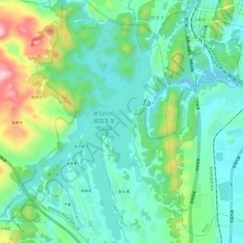
Name: 阿哈水库 topographic map, elevation, terrain.
Location: 阿哈水库, 花溪区, 贵阳市, 贵州省, 中国 (26.51057 106.61874 26.56243 106.65492)
Average elevation: 3,802 ft
Minimum elevation: 3,527 ft
Maximum elevation: 4,544 ft
Other topographic maps
Click on a map to view its topography, its elevation and its terrain.