
高坡苗族乡 topographic map
Interactive map
Click on the map to display elevation.
About this map
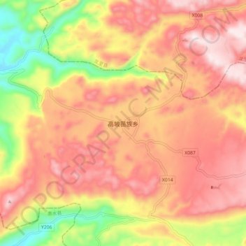
Name: 高坡苗族乡 topographic map, elevation, terrain.
Location: 高坡苗族乡, 贵阳市, 贵州省, 中国 (26.26026 106.76912 26.34026 106.84912)
Average elevation: 4,646 ft
Minimum elevation: 3,507 ft
Maximum elevation: 5,420 ft
Other topographic maps
Click on a map to view its topography, its elevation and its terrain.