Geolocate

Altapass topographic map

Click on the map to display elevation.

About this map

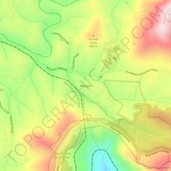
Name: Altapass topographic map, elevation, terrain.

Location: Altapass, Mitchell County, North Carolina, 28777, United States (35.87346 -82.03789 35.91346 -81.99789)

Average elevation: 2,802 ft

Minimum elevation: 1,955 ft

Maximum elevation: 3,645 ft

Mitchell County trails, hiking, mountain biking, running and outdoor activities

Other topographic maps

Click on a map to view its topography, its elevation and its terrain.

Bad Creek

United States > North Carolina > Mitchell County > Peppers

Average elevation: 2,638 ft

Gear up for your next adventure:

🎁Geography Themed Gifts - Unique gift ideas for map lovers and geography enthusiasts
📡GPS Antenna Upgrade - Enhance GPS reception in remote terrain
🦶Hiking Gaiters - Keep debris and water out of your boots
🎒Trail Energy Bars - High‑calorie bars for hiking energy
🪑Portable Camp Table - Compact table for campsite meals

As an Amazon Associate, this site earns from qualifying purchases at no extra cost to you.