
Delray Junction topographic map
Click on the map to display elevation.
About this map
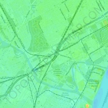
Name: Delray Junction topographic map, elevation, terrain.
Average elevation: 591 ft
Minimum elevation: 554 ft
Maximum elevation: 653 ft
Wayne County trails, hiking, mountain biking, running and outdoor activities
Other topographic maps
Click on a map to view its topography, its elevation and its terrain.
Detroit River
United States > Michigan > Wayne County > Detroit
The Detroit River is only 0.5–2.5 miles (0.8–4.0 km) wide. It begins with an east-to-west flow from Lake St. Clair, but curves and runs north to south. The deepest portion of the Detroit River is 53 feet (16.2 m) in its northern portion. At its source, the river is at an elevation of 574 feet (175 m) above…
Average elevation: 600 ft