
Detroit River topographic map
Click on the map to display elevation.
Detroit River
The Detroit River is only 0.5–2.5 miles (0.8–4.0 km) wide. It begins with an east-to-west flow from Lake St. Clair, but curves and runs north to south. The deepest portion of the Detroit River is 53 feet (16.2 m) in its northern portion. At its source, the river is at an elevation of 574 feet (175 m) above sea level. The river is relatively level, dropping only 3 feet (0.9 m) before entering Lake Erie at 571 feet (174 m). As the river contains no dams and no locks, it is easily navigable by even the smallest of vessels. The watershed basin for the Detroit River is approximately 700 square miles (1,800 km2).
About this map
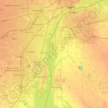
Name: Detroit River topographic map, elevation, terrain.
Average elevation: 600 ft
Minimum elevation: 446 ft
Maximum elevation: 715 ft
Wayne County trails, hiking, mountain biking, running and outdoor activities
Other topographic maps
Click on a map to view its topography, its elevation and its terrain.