
Sire topographic map
Click on the map to display elevation.
Sire
Sire (also transliterated "Sirie") is a town in south-western Oromia. Located in the Arsi Zone of the Oromia, Ethiopia. This town has a latitude and longitude of 08°17′N 39°27′E / 8.283°N 39.450°E / 8.283; 39.450 with an altitude of 1793 meters above sea level. It is administrative center of Sire woreda (Aanaa Siree in Oromo language). Currently Sire District or Aanaa Siree is divided in to seventeen rural administrative communes or Kebele peasant Associations (in oromo, Araddaa Waldaya Qotebultoota ) and one urban town administration. The rural community or Araddaa in Sire District are the following: Alelu Gasala (Aleelu Gasalaa), Amola Tebbo (Amoolaa Xabboo), Amola Chancho (Amoolaa Caancoo), Borera Chireo (Booraraa Cira'oo), Dankicha Gafarsa (Dhanqicha Gafarsaa), Gasala Amuta (Gasala Amuxaa), Gasala Chacha (Gasala Caaccaa), Gasala Shashe (Gasala Shaashee), Huduga Borano (Huduga Booranoo), Ibseta Huduga (Ibsataa Hudugaa) Koloba Hawas (Kolooba Hawaas), Koloba Bikka (Kolooba Biiqqaa), Koloba Balie (Kolooba Balee), Koloba Shamida (Kolooba Shaamidaa), Lodie Banban (Loodee Banban), Lodie Lammffo (Loodee Lammaffoo) and Ufura Hagamsa (Ufuraa Hagamsaa), The urban Araddaa administration is Sire 01 Araddaa.
About this map
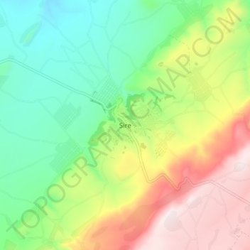
Name: Sire topographic map, elevation, terrain.
Location: Sire, Arsi, Oromia Region, Ethiopia (8.23641 39.45274 8.31641 39.53274)
Average elevation: 6,670 ft
Minimum elevation: 5,614 ft
Maximum elevation: 8,320 ft
Other topographic maps
Click on a map to view its topography, its elevation and its terrain.
Moyale
Moyale has a hot semi-arid climate (Köppen BSh) moderated somewhat by altitude. Typically for East Africa, there are two rainy seasons: the “long rains” from March to May and the weaker, less reliable “short rains” in October and November.
Average elevation: 3,593 ft
Moyale
Moyale has a hot semi-arid climate (Köppen BSh) moderated somewhat by altitude. Typically for East Africa, there are two rainy seasons: the “long rains” from March to May and the weaker, less reliable “short rains” in October and November.
Average elevation: 3,593 ft
Asela
Asella (Oromo: Asallaa, Amharic: አሰላ) is a town in central Ethiopia. Located in the Arsi Zone of the Oromia Region 126 km (78 mi) south from Addis Ababa, this town has a latitude and longitude of 7°57′N 39°7′E / 7.950°N 39.117°E / 7.950; 39.117, with an elevation of 2,430 meters. Asella…
Average elevation: 7,969 ft
Lake Abaya
The only outflow of the lake is through the lower reaches of Kulfo River directly below an alluvial fan at an elevation of 1,190 m (at 6°00′39″N 37°35′07″E / 6.0109°N 37.5854°E / 6.0109; 37.5854). The riverbed acts as an spillway in the case of high lake levels and discharges the excess…
Average elevation: 4,826 ft
Harena Forest
The Harenna Forest is a montane tropical evergreen forest in Ethiopia's Bale Mountains. The forest covers the southern slope of the mountains, extending from 1450 to 3200 meters elevation. The Bale Mountains are in Ethiopia's Oromia Region, and form the southwestern portion of the Ethiopian Highlands.
Average elevation: 6,654 ft
Asela
Asella (Oromo: Asallaa, Amharic: አሰላ) is a town in central Ethiopia. Located in the Arsi Zone of the Oromia Region 156 km (97 mi) south from Addis Ababa, this town has a latitude and longitude of 7°57′N 39°7′E / 7.950°N 39.117°E / 7.950; 39.117, with an elevation of 2,430 meters. Asella…
Average elevation: 7,969 ft