Geolocate

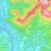
Soccher topographic map

Click on the map to display elevation.

About this map

Name: Soccher topographic map, elevation, terrain.

Location: Soccher, Ponte nelle Alpi, Belluno, Veneto, 32014, Italia (46.16240 12.28989 46.20240 12.32989)

Average elevation: 2,064 ft

Minimum elevation: 1,184 ft

Maximum elevation: 6,302 ft

Other topographic maps

Click on a map to view its topography, its elevation and its terrain.
Lago di Santa Croce

Italia > Veneto > Belluno > Farra d'Alpago

Average elevation: 1,778 ft

Lago di Alleghe

Italia > Veneto > Belluno > Alleghe > Masarè > Cordella

Average elevation: 4,029 ft

Fiume Piave

Italia > Veneto > Belluno > Dussoi

Average elevation: 1,132 ft

Monte Civetta

Italia > Veneto > Belluno

Average elevation: 5,128 ft

Lago di Misurina

Italia > Veneto > Belluno > Auronzo di Cadore > Misurina

Average elevation: 6,247 ft

Tofane

Italia > Veneto > Belluno > Cortina d'Ampezzo

Costruita nella seconda metà del XX secolo e divisa in tre tronconi, la funivia Freccia nel Cielo è il più diretto mezzo di trasporto per raggiungere la cima della Tofana di Mezzo. La base (1.250 m s.l.m.), o prima stazione, si trova infatti nel pieno centro di Cortina, proprio davanti al famoso Stadio…

Average elevation: 7,530 ft

Alano di Piave

Italia > Veneto > Belluno > Alano di Piave

Average elevation: 1,906 ft

Trichiana

Italia > Veneto > Belluno

Average elevation: 1,818 ft

Pieve d'Alpago

Italia > Veneto > Belluno

Average elevation: 2,884 ft

Gear up for your next adventure:

🗃️Trail First Aid Kit - Essential kit for outdoor injuries and emergencies
📦Gear Storage Bags - Organize and protect outdoor equipment
🦶Hiking Gaiters - Keep debris and water out of your boots
😴Insulated Sleeping Pads - Compact and warm pads for high-elevation camping
🗺️Topographic Maps - Detailed topo maps for hiking, exploring and outdoor navigation

As an Amazon Associate, this site earns from qualifying purchases at no extra cost to you.