Geolocate

Randolph topographic map

Click on the map to display elevation.

About this map

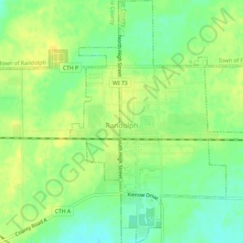
Name: Randolph topographic map, elevation, terrain.

Location: Randolph, Dodge County, Wisconsin, 53956, United States (43.52598 -89.01470 43.55303 -88.98609)

Average elevation: 961 ft

Minimum elevation: 919 ft

Maximum elevation: 991 ft

Dodge County trails, hiking, mountain biking, running and outdoor activities

Other topographic maps

Click on a map to view its topography, its elevation and its terrain.

Ashippun

United States > Wisconsin > Dodge County

Average elevation: 892 ft

Burnett

United States > Wisconsin > Dodge County

Average elevation: 892 ft

Rubicon

United States > Wisconsin > Dodge County

Average elevation: 1,040 ft

Lebanon

United States > Wisconsin > Dodge County

Average elevation: 912 ft

Gear up for your next adventure:

🥇GPS Hiking Watch - Multi‑sport GPS watch with navigation and trail tracking
🧥Men's Rain Shells - Premium waterproof and breathable jackets for mountain weather
🥾Men's Hiking Boots - Durable, waterproof footwear for rugged terrain and steep inclines
🧭Outdoor Navigation Book - Learn advanced navigation skills
🍳Camping Cook Set - Complete cookware for outdoor meals

As an Amazon Associate, this site earns from qualifying purchases at no extra cost to you.