Geolocate

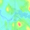
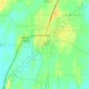
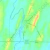
Lebanon topographic map

Click on the map to display elevation.

About this map

Name: Lebanon topographic map, elevation, terrain.

Location: Lebanon, Town of Lebanon, Dodge County, Wisconsin, 53047, United States (43.23586 -88.64677 43.27586 -88.60677)

Average elevation: 912 ft

Minimum elevation: 837 ft

Maximum elevation: 1,017 ft

Dodge County trails, hiking, mountain biking, running and outdoor activities

Other topographic maps

Click on a map to view its topography, its elevation and its terrain.
Randolph

United States > Wisconsin > Dodge County

Average elevation: 961 ft

Neosho

United States > Wisconsin > Dodge County

Average elevation: 915 ft

Iron Ridge

United States > Wisconsin > Dodge County

Average elevation: 938 ft

Town of Westford

United States > Wisconsin > Dodge County

Average elevation: 906 ft

Fox Lake

United States > Wisconsin > Dodge County

Average elevation: 906 ft

Juneau

United States > Wisconsin > Dodge County

Average elevation: 896 ft

Brownsville

United States > Wisconsin > Dodge County

Average elevation: 1,010 ft

Clyman

United States > Wisconsin > Dodge County

Average elevation: 899 ft

Kekoskee

United States > Wisconsin > Dodge County

Average elevation: 896 ft

Lowell

United States > Wisconsin > Dodge County

Average elevation: 823 ft

Town of Shields

United States > Wisconsin > Dodge County

Average elevation: 827 ft

Gear up for your next adventure:

🪶Fire Starter Kit - Reliable fire starter for survival and camping
🧭Map Reading Tools - Tools and kits for map navigation
🧯Portable Fire Pit - Compact fire pit for camping spots
🧥Men's Rain Shells - Premium waterproof and breathable jackets for mountain weather
🧭Compass with Lanyard - Easy‑carry compass for navigation

As an Amazon Associate, this site earns from qualifying purchases at no extra cost to you.