Geolocate

Springfield topographic map

Click on the map to display elevation.

About this map

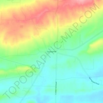
Name: Springfield topographic map, elevation, terrain.

Location: Springfield, Conway County, Arkansas, 72157, United States (35.24758 -92.57766 35.28758 -92.53766)

Average elevation: 459 ft

Minimum elevation: 305 ft

Maximum elevation: 709 ft

Conway County trails, hiking, mountain biking, running and outdoor activities

Other topographic maps

Click on a map to view its topography, its elevation and its terrain.

Menifee

United States > Arkansas > Conway County

Average elevation: 318 ft

Oppelo

United States > Arkansas > Conway County

Average elevation: 318 ft

Plumerville

United States > Arkansas > Conway County

Average elevation: 348 ft

Morrilton

United States > Arkansas > Conway County

Average elevation: 338 ft

Gear up for your next adventure:

🎒Trekking Poles - Sturdy poles for balance and stability on rough terrain
🔥Plasma Lighters - Windproof lighters that work in any weather condition
🧭Pro Hiking Compasses - High-accuracy liquid-filled compasses for topographic orientation
📷Action Cameras - Rugged cameras to document your journeys across rugged terrain
🚁Photography Drones - Capture stunning aerial views of landforms and topography

As an Amazon Associate, this site earns from qualifying purchases at no extra cost to you.