Andechs topographic map
Click on the map to display elevation.
Andechs
Die Gemeinde liegt auf einem Höhenrücken zwischen dem Ammersee im Westen und dem Starnberger See im Osten. Der Rücken entstand durch Gletscherablagerungen zwischen den beiden Haupt-Gletscherzungen des Isar-Loisach-Gletschers, die für die beiden Zungenbeckenseen verantwortlich waren und weist auf seiner Oberfläche Strukturen von Endmoränen auf. Die Gemeinde liegt im Zentrum des Fünfseenlandes und hat fünf Gemeindeteile: das Kloster Andechs, die Pfarrdörfer Erling, Frieding und Machtlfing und die Anstalt Rothenfeld.
About this map
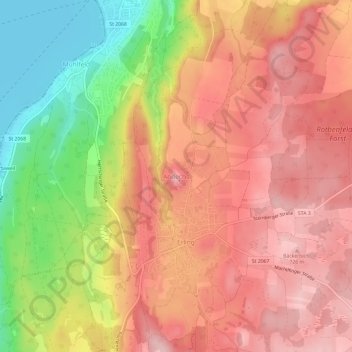
Name: Andechs topographic map, elevation, terrain.
Location: Andechs, Landkreis Starnberg, Bayern, 82346, Deutschland (47.95464 11.16282 47.99464 11.20282)
Average elevation: 2,119 ft
Minimum elevation: 1,742 ft
Maximum elevation: 2,356 ft
Other topographic maps
Click on a map to view its topography, its elevation and its terrain.