Geolocate

Lafayette topographic map

Click on the map to display elevation.

About this map

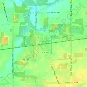
Name: Lafayette topographic map, elevation, terrain.

Location: Lafayette, Allen County, Ohio, 45854, United States (40.75433 -83.95632 40.76262 -83.94526)

Average elevation: 938 ft

Minimum elevation: 896 ft

Maximum elevation: 974 ft

Allen County trails, hiking, mountain biking, running and outdoor activities

Other topographic maps

Click on a map to view its topography, its elevation and its terrain.

Lima

United States > Ohio > Allen County

Average elevation: 876 ft

Gomer

United States > Ohio > Allen County

Average elevation: 778 ft

Westminster

United States > Ohio > Allen County

Average elevation: 965 ft

Allentown

United States > Ohio > Allen County > Lima

Average elevation: 820 ft

Conant

United States > Ohio > Allen County

Average elevation: 823 ft

Hume

United States > Ohio > Allen County

Average elevation: 853 ft

Kemp

United States > Ohio > Allen County

Average elevation: 840 ft

Landeck

United States > Ohio > Allen County

Average elevation: 794 ft

Maysville

United States > Ohio > Allen County

Average elevation: 1,007 ft

Rockport

United States > Ohio > Allen County

Average elevation: 814 ft

Scotts Crossing

United States > Ohio > Allen County

Average elevation: 784 ft

South Warsaw

United States > Ohio > Allen County

Average elevation: 928 ft

Southworth

United States > Ohio > Allen County

Average elevation: 810 ft

West Newton

United States > Ohio > Allen County

Average elevation: 1,037 ft

Gear up for your next adventure:

🧴Hand Sanitizer - Keep hands clean while hiking
🏔️Mountain Trail Maps - High‑detail maps for popular peaks
🛰️Satellite Messengers - Emergency SOS and two-way messaging for off-grid adventures
🪶Compact Camp Shovel - Folding shovel for campsite tasks
🛶Inflatable Kayak - Portable kayak for rivers, lakes, and expeditions

As an Amazon Associate, this site earns from qualifying purchases at no extra cost to you.