Geolocate

L'Assomption topographic map

Click on the map to display elevation.

About this map
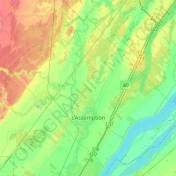
Name: L'Assomption topographic map, elevation, terrain.

Location: L'Assomption, L'Assomption (MRC), Lanaudière, Quebec, Canada (45.77405 -73.49568 45.94354 -73.34502)

Average elevation: 75 ft

Minimum elevation: 7 ft

Maximum elevation: 187 ft

Gear up for your next adventure:

🔦Powerful Headlamps - Ultra-bright hands-free lighting for night navigation
🛌Ultralight Sleeping Bags - Compact down bags for cold nights in the wilderness
🪶Survival Guide Book - Expert advice for emergency preparedness
🪑Ultralight Camp Chairs - Portable seating for resting after a long day of mapping
🥾Hiking Shoes - Durable and comfortable shoes for trail hiking

As an Amazon Associate, this site earns from qualifying purchases at no extra cost to you.