Geolocate

Ignace topographic map

Click on the map to display elevation.

About this map

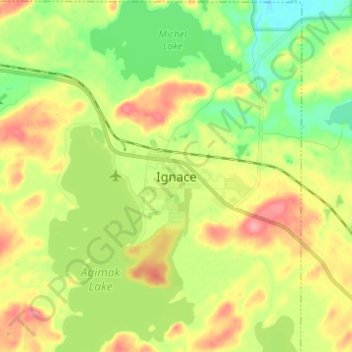
Name: Ignace topographic map, elevation, terrain.

Location: Ignace, Ignace Township, Kenora District, Northwestern Ontario, Ontario, P0T 1T0, Canada (49.37276 -91.69482 49.45276 -91.61482)

Average elevation: 1,490 ft

Minimum elevation: 1,355 ft

Maximum elevation: 1,663 ft

Gear up for your next adventure:

🗻Climbing Gear Basics - Essential gear for beginner climbers
🔥Plasma Lighters - Windproof lighters that work in any weather condition
🏫Relief Map Kits - Hands-on tools for teaching landforms and elevation
📦Gear Storage Bags - Organize and protect outdoor equipment
Solar GPS Watches - Advanced multisport watches with built-in topographic maps

As an Amazon Associate, this site earns from qualifying purchases at no extra cost to you.