Geolocate

Belgrade topographic map

Click on the map to display elevation.

About this map

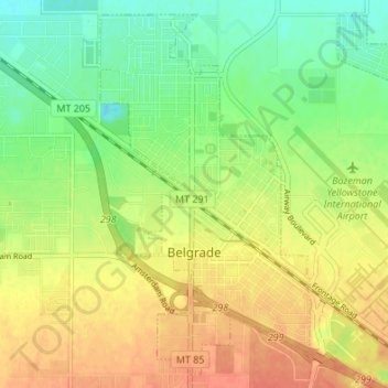
Name: Belgrade topographic map, elevation, terrain.

Location: Belgrade, Gallatin County, Montana, 59714, United States (45.75842 -111.20105 45.80215 -111.13351)

Average elevation: 4,446 ft

Minimum elevation: 4,370 ft

Maximum elevation: 4,514 ft

Gallatin County trails, hiking, mountain biking, running and outdoor activities

Other topographic maps

Click on a map to view its topography, its elevation and its terrain.

Bozeman

United States > Montana > Gallatin County

Bozeman is located at an elevation of 4,820 feet (1,470 m). The Bridger Mountains are to the north-northeast, the Tobacco Root Mountains to the west-southwest, the Big Belt Mountains and Horseshoe Hills to the northwest, the Hyalite Peaks of the northern Gallatin Range to the south and the Spanish Peaks of the…

Average elevation: 5,509 ft

Grayling

United States > Montana > Gallatin County

Average elevation: 6,939 ft

Logan

United States > Montana > Gallatin County

Average elevation: 4,245 ft

Gallatin River

United States > Montana > Gallatin County

Average elevation: 4,951 ft

Clarkston

United States > Montana > Gallatin County

Average elevation: 4,055 ft

Gear up for your next adventure:

🪶Camp Gear Gift Set - Perfect gift bundle for outdoor fans
🌎3D Topographic Globes - Raised relief globes for a tactile understanding of geography
🕶️Glacier Sunglasses - Side shields to protect eyes from high-altitude snow glare
🧭Map Reading Tools - Tools and kits for map navigation
🧭GPS Watch Accessories - Bands and chargers for GPS watches

As an Amazon Associate, this site earns from qualifying purchases at no extra cost to you.