
Rosebud topographic map
Click on the map to display elevation.
About this map
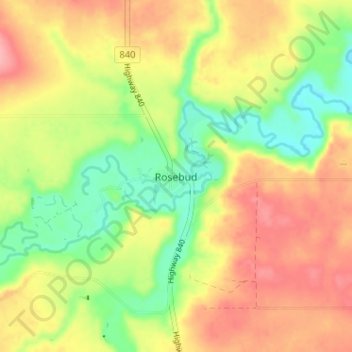
Name: Rosebud topographic map, elevation, terrain.
Location: Rosebud, Wheatland County, Alberta, T0J 2T0, Canada (51.28000 -112.97000 51.32000 -112.93000)
Average elevation: 2,703 ft
Minimum elevation: 2,530 ft
Maximum elevation: 2,867 ft
Other topographic maps
Click on a map to view its topography, its elevation and its terrain.