
Jurong Island topographic map
Interactive map
Click on the map to display elevation.
About this map
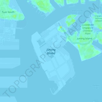
Name: Jurong Island topographic map, elevation, terrain.
Location: Jurong Island, Southwest, Singapore (1.22261 103.65375 1.29663 103.74019)
Average elevation: 3 ft
Minimum elevation: -20 ft
Maximum elevation: 141 ft
Other topographic maps
Click on a map to view its topography, its elevation and its terrain.
Jurong Hill Park
Jurong Hill Park, Boon Lay, Southwest, Singapore
Average elevation: 36 ft
Bishan-Ang Mo Kio Park
Bishan-Ang Mo Kio Park, Ang Mo Kio Neighbourhood Marker Sign, Bishan, Central, Singapore
Average elevation: 69 ft
Bukit Batok Nature Park
Bukit Batok Nature Park, Bukit Batok East Avenue 6, Bukit Batok, Southwest, 659761, Singapore
Average elevation: 148 ft
Bishan Active Park
Bishan Active Park, Bishan, Singapore, Central, Singapore
Average elevation: 62 ft
Raffles Lighthouse
Raffles Lighthouse, Southern Islands, Southwest, Singapore
Average elevation: 3 ft
Lower Peirce Reservoir
Lower Peirce Reservoir, Boardwalk, Ang Mo Kio Neighbourhood Marker Sign, Thomson, Singapore, Central, 574416, Singapore
Average elevation: 108 ft
Palau Tekong Camp
Palau Tekong Camp, Kampong Ladang, Southeast, Singapore
Average elevation: 16 ft
Bedok Reservoir
Bedok Reservoir, Obstacle Course at Forest Adventure, Tampines, Northeast, 479233, Singapore
Average elevation: 75 ft
Little Guilin
Little Guilin, Bukit Batok East Park Connector, Bukit Gombak, Bukit Batok, Southwest, 650257, Singapore
Average elevation: 125 ft
Bukit Timah Nature Reserve
Bukit Timah Nature Reserve, Lorong Pisang Udang, Bukit Batok, Southwest, 598681, Singapore
Average elevation: 171 ft