Geolocate

Aurora topographic map

Click on the map to display elevation.

About this map

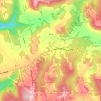
Name: Aurora topographic map, elevation, terrain.

Location: Aurora, Preston County, West Virginia, 26705, United States (39.30427 -79.57450 39.34427 -79.53450)

Average elevation: 2,664 ft

Minimum elevation: 2,136 ft

Maximum elevation: 3,022 ft

Preston County trails, hiking, mountain biking, running and outdoor activities

Other topographic maps

Click on a map to view its topography, its elevation and its terrain.

Terra Alta

United States > West Virginia > Preston County

Average elevation: 2,543 ft

Rowlesburg

United States > West Virginia > Preston County

Average elevation: 1,850 ft

Big Bear Lake

United States > West Virginia > Preston County

Average elevation: 2,585 ft

Newburg

United States > West Virginia > Preston County

Average elevation: 1,480 ft

Gear up for your next adventure:

📶Vehicle Signal Boosters - Improve reception in rural areas while driving to trailheads
🎒Waterproof Dry Bags - Keep your electronics and maps dry inside your pack
🥾Men's Hiking Boots - Durable, waterproof footwear for rugged terrain and steep inclines
🛠️Backpacking Tool Kit - Essential toolkit for outdoor repairs
☀️Outdoor Sunscreen - High protection sunscreen for outdoor activities

As an Amazon Associate, this site earns from qualifying purchases at no extra cost to you.