Geolocate

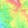
Cofton Hackett CP topographic map

Click on the map to display elevation.

About this map
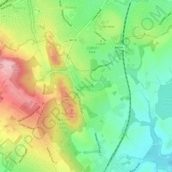
Name: Cofton Hackett CP topographic map, elevation, terrain.

Location: Cofton Hackett CP, Bromsgrove, Worcestershire, England, United Kingdom (52.36450 -2.01136 52.39217 -1.95975)

Average elevation: 656 ft

Minimum elevation: 430 ft

Maximum elevation: 978 ft

Other topographic maps

Click on a map to view its topography, its elevation and its terrain.

Dodford

United Kingdom > England > Worcestershire > Bromsgrove

Average elevation: 381 ft

Rubery

United Kingdom > England > Worcestershire > Bromsgrove

Average elevation: 699 ft

Cobley Hill

United Kingdom > England > Worcestershire > Bromsgrove

Average elevation: 502 ft

Blackwell

United Kingdom > England > Worcestershire > Bromsgrove > Blackwell

Average elevation: 531 ft

Hopwood

United Kingdom > England > Worcestershire > Bromsgrove

Average elevation: 525 ft

Lickey End

United Kingdom > England > Worcestershire > Bromsgrove

Average elevation: 472 ft

Rednal Hill

United Kingdom > England > Worcestershire > Bromsgrove

Average elevation: 705 ft

Stoke Pound

United Kingdom > England > Worcestershire > Bromsgrove

Average elevation: 282 ft

Inkford

United Kingdom > England > Worcestershire > Bromsgrove > Wythall CP

Average elevation: 525 ft

Catshill

United Kingdom > England > Worcestershire > Bromsgrove

Average elevation: 495 ft

Clent Hills

United Kingdom > England > Worcestershire > Bromsgrove > Clent

Average elevation: 689 ft

Gear up for your next adventure:

🦟Ultrasonic Repellers - Create a bug-free zone at your camp or rest stop
📦Gear Storage Bags - Organize and protect outdoor equipment
📖Nature Tracking Books - Learn to track wildlife and terrain
🩹Survival Bandages - High‑quality bandages for emergencies
🧭Pro Hiking Compasses - High-accuracy liquid-filled compasses for topographic orientation

As an Amazon Associate, this site earns from qualifying purchases at no extra cost to you.