Geolocate

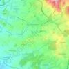
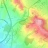
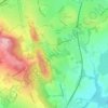
Dodford topographic map

Click on the map to display elevation.

About this map

Name: Dodford topographic map, elevation, terrain.

Location: Dodford, Bromsgrove, Worcestershire, England, B61 9BU, United Kingdom (52.33531 -2.12338 52.37531 -2.08338)

Average elevation: 381 ft

Minimum elevation: 200 ft

Maximum elevation: 600 ft

Other topographic maps

Click on a map to view its topography, its elevation and its terrain.
Romsley CP

United Kingdom > England > Worcestershire > Bromsgrove

Average elevation: 673 ft

Finstall CP

United Kingdom > England > Worcestershire > Bromsgrove

Average elevation: 361 ft

Beoley CP

United Kingdom > England > Worcestershire > Bromsgrove > Holt End

Average elevation: 440 ft

Clent

United Kingdom > England > Worcestershire > Bromsgrove

Because of the hilly topography of the parish the village consists of several distinct hamlets. These are Upper Clent (Clatterbach and the area around the parish church of St. Leonard), Lower Clent, Holy Cross, Adams Hill and Walton Pool. The Civil Parish of Clent also included part of the village of West…

Average elevation: 604 ft
Romsley CP

United Kingdom > England > Worcestershire > Bromsgrove

Average elevation: 673 ft

Wythall CP

United Kingdom > England > Worcestershire > Bromsgrove

Average elevation: 509 ft

Wythall CP

United Kingdom > England > Worcestershire > Bromsgrove

Average elevation: 509 ft

Gear up for your next adventure:

📦Dry Bags Set - Waterproof storage for electronics and clothes
🔭Telescopic Hiking Pole - Adjustable pole for hiking stability
🚪Portable Camp Chair - Foldable chair for comfort at camp
👓Polarized Sunglasses - Outdoor sunglasses for glare reduction
🪶Survival Guide Book - Expert advice for emergency preparedness

As an Amazon Associate, this site earns from qualifying purchases at no extra cost to you.