
Embudo Canyon topographic map
Click on the map to display elevation.
About this map
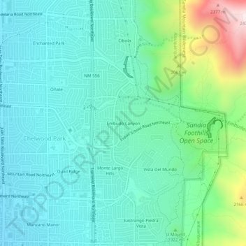
Name: Embudo Canyon topographic map, elevation, terrain.
Average elevation: 6,096 ft
Minimum elevation: 5,548 ft
Maximum elevation: 8,058 ft
Bernalillo County trails, hiking, mountain biking, running and outdoor activities
Other topographic maps
Click on a map to view its topography, its elevation and its terrain.
Joe M. Lucero Hillside
United States > New Mexico > Bernalillo County > Albuquerque
Average elevation: 5,371 ft