
沙甸鎮 topographic map
Interactive map
Click on the map to display elevation.
About this map
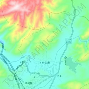
Name: 沙甸鎮 topographic map, elevation, terrain.
Location: 沙甸鎮, 个旧市, 红河哈尼族彝族自治州, 云南省, 中国 (23.51999 103.20986 23.57350 103.28813)
Average elevation: 4,426 ft
Minimum elevation: 3,852 ft
Maximum elevation: 5,837 ft
Other topographic maps
Click on a map to view its topography, its elevation and its terrain.