Geolocate

Neustadt topographic map

Click on the map to display elevation.

About this map

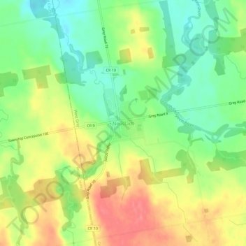
Name: Neustadt topographic map, elevation, terrain.

Location: Neustadt, West Grey, Grey County, Ontario, N0G 2M0, Canada (44.05783 -81.02066 44.09783 -80.98066)

Average elevation: 988 ft

Minimum elevation: 876 ft

Maximum elevation: 1,112 ft

Gear up for your next adventure:

👟Trail Running Shoes - Lightweight shoes for trail runners
🎒Gear Packing Cubes - Organize your backpack efficiently
🔋Rechargeable Batteries - Power up your outdoor devices
💧Water Purification System - Clean water on the trail with reliable purifiers
🏥Hiking First Aid Kits - Comprehensive medical kits for remote trail injuries

As an Amazon Associate, this site earns from qualifying purchases at no extra cost to you.