Geolocate

Hildesheim topographic map

Click on the map to display elevation.

About this map

Name: Hildesheim topographic map, elevation, terrain.

Location: Hildesheim, Landkreis Hildesheim, Nedersaksen, Duitsland, Halsberg (52.13484 9.86730 52.13494 9.86740)

Average elevation: 512 ft

Minimum elevation: 312 ft

Maximum elevation: 853 ft

Other topographic maps

Click on a map to view its topography, its elevation and its terrain.
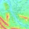
Hildesheim

Duitsland > Nedersaksen > Landkreis Hildesheim

Average elevation: 394 ft

Giesen

Duitsland > Nedersaksen > Landkreis Hildesheim

Average elevation: 269 ft

Gear up for your next adventure:

🛰️Satellite Messengers - Emergency SOS and two-way messaging for off-grid adventures
🔥Fast-Boil Camping Stoves - Efficient cooking systems for quick trail meals
🔌USB Car Charger - Car charger for on‑the‑go power needs
👟Men's Trail Runners - Lightweight footwear for fast-paced exploration and light hiking
📱Heavy-Duty Phone Cases - Drop-proof and waterproof protection for outdoor navigation

As an Amazon Associate, this site earns from qualifying purchases at no extra cost to you.