
Oed topographic map
Click on the map to display elevation.
About this map
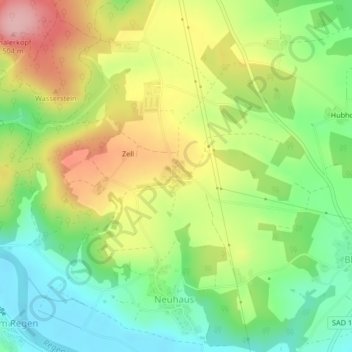
Name: Oed topographic map, elevation, terrain.
Average elevation: 1,348 ft
Minimum elevation: 1,119 ft
Maximum elevation: 1,654 ft
Other topographic maps
Click on a map to view its topography, its elevation and its terrain.
Obermainsbach
Deutschland > Bayern > Landkreis Schwandorf > Nittenau > Bleich
Average elevation: 1,263 ft
Hof am Regen
Deutschland > Bayern > Landkreis Schwandorf > Nittenau > Hof am Regen
Average elevation: 1,371 ft
Gunt
Deutschland > Bayern > Landkreis Schwandorf > Nittenau > Hof am Regen
Average elevation: 1,391 ft
Stefling
Deutschland > Bayern > Landkreis Schwandorf > Nittenau
Annahaid | Asang | Auhof | Bachbügl | Bergham | Berghof | Berglarn | Bleich | Bodenstein | Brunn | Diepenried | Dobl | Dürrmaul | Eckartsreuth | Eichlgütl | Elendhof | Entermainsbach | Eschlbach | Fichtenhof | Fischbach | Forsting | Geiseck | Goppeltshof | Gunt | Hadriwa (Nittenau) | Haiderhöf |…
Average elevation: 1,407 ft
Vorderkohlstetten
Deutschland > Bayern > Landkreis Schwandorf > Nittenau > Hof am Regen
Average elevation: 1,407 ft