
Kangaatsiaq topographic map
Interactive map
Click on the map to display elevation.
About this map
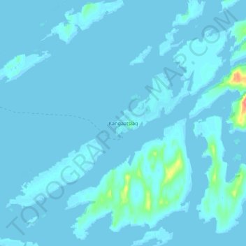
Name: Kangaatsiaq topographic map, elevation, terrain.
Location: Kangaatsiaq, Qeqertalik, Greenland (68.26915 -53.50149 68.34915 -53.42149)
Average elevation: 10 ft
Minimum elevation: -16 ft
Maximum elevation: 236 ft
Other topographic maps
Click on a map to view its topography, its elevation and its terrain.
Qeqertarsuaq
Qeqertarsuaq, Qeqertalik, 3953, Greenland
Average elevation: 312 ft
Qasigiannguit
Qasigiannguit, Qeqertalik, 3951, Greenland
Average elevation: 253 ft