Geolocate

Valkenburg topographic map

Click on the map to display elevation.

About this map

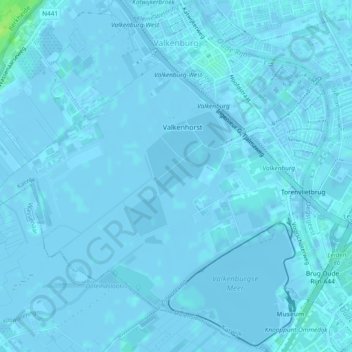
Name: Valkenburg topographic map, elevation, terrain.

Location: Valkenburg, Katwijk, South Holland, Netherlands (52.15565 4.40411 52.18437 4.44885)

Average elevation: 0 ft

Minimum elevation: -16 ft

Maximum elevation: 43 ft

Other topographic maps

Click on a map to view its topography, its elevation and its terrain.

Botlek

Netherlands > South Holland

Average elevation: 10 ft

Langeraar

Netherlands > South Holland

Average elevation: -10 ft

Meije

Netherlands > South Holland > Nieuwkoop

Average elevation: -7 ft

Weerestein

Netherlands > South Holland > Hillegom

Average elevation: 0 ft

Broekhuizen

Netherlands > South Holland > Gouda

Average elevation: -3 ft

Ankerpark

Netherlands > South Holland > Leiden

Average elevation: 10 ft

Middelsluis

Netherlands > South Holland > Numansdorp

Average elevation: 0 ft

Weerestein

Netherlands > South Holland > Hillegom

Average elevation: 0 ft

Meijendel

Netherlands > South Holland > Wassenaar

Average elevation: 20 ft

Coepelduynen

Netherlands > South Holland > Katwijk

Average elevation: 13 ft

Het Park

Netherlands > South Holland > Rotterdam

Average elevation: 13 ft

Waalhaven

Netherlands > South Holland > Rotterdam

Average elevation: 10 ft

Gear up for your next adventure:

🧭Orienteering Set - Complete compass and map reading kit
🛰️Handheld GPS Units - Professional satellite navigators for precise backcountry mapping
🔌USB Car Charger - Car charger for on‑the‑go power needs
🚗GPS Dash Cams - Record your scenic drives through mountain passes and canyons
🪑Ultralight Camp Chairs - Portable seating for resting after a long day of mapping

As an Amazon Associate, this site earns from qualifying purchases at no extra cost to you.