Geolocate

Mount Washington topographic map

Click on the map to display elevation.

About this map

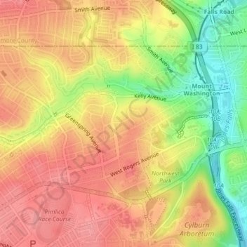
Name: Mount Washington topographic map, elevation, terrain.

Location: Mount Washington, Baltimore, Maryland, United States (39.35501 -76.68166 39.37196 -76.64999)

Average elevation: 358 ft

Minimum elevation: 174 ft

Maximum elevation: 472 ft

Maryland trails, hiking, mountain biking, running and outdoor activities

Other topographic maps

Click on a map to view its topography, its elevation and its terrain.

Ravens' Walk

United States > Maryland > Baltimore

Average elevation: 49 ft

Riverside Park

United States > Maryland > Baltimore

Average elevation: 16 ft

Gear up for your next adventure:

🪶Camping Sleeping Pad - Comfortable sleeping pad for backpacking
🔊Portable Camp Speaker - Music and alerts at camp
🕶️Glacier Sunglasses - Side shields to protect eyes from high-altitude snow glare
🛶Inflatable Kayak - Portable kayak for rivers, lakes, and expeditions
🏫Relief Map Kits - Hands-on tools for teaching landforms and elevation

As an Amazon Associate, this site earns from qualifying purchases at no extra cost to you.