Geolocate

Black Earth topographic map

Click on the map to display elevation.

About this map

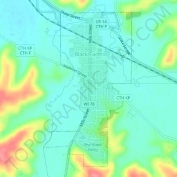
Name: Black Earth topographic map, elevation, terrain.

Location: Black Earth, Dane County, Wisconsin, United States (43.12074 -89.75772 43.14448 -89.73931)

Average elevation: 856 ft

Minimum elevation: 787 ft

Maximum elevation: 1,037 ft

Other topographic maps

Click on a map to view its topography, its elevation and its terrain.

Waunakee Marsh

United States > Wisconsin > Dane County > Waunakee

Average elevation: 958 ft

Observatory Hill

United States > Wisconsin > Dane County > Madison

Average elevation: 873 ft

Buss's Corners

United States > Wisconsin > Dane County

Average elevation: 948 ft

Table Bluff

United States > Wisconsin > Dane County

Average elevation: 1,004 ft

Stoughton

United States > Wisconsin > Dane County > Stoughton

Average elevation: 886 ft

Bowens Addition

United States > Wisconsin > Dane County > Madison

Average elevation: 873 ft

Marxville

United States > Wisconsin > Dane County > Town of Berry

Average elevation: 984 ft

East Bristol

United States > Wisconsin > Dane County

Average elevation: 935 ft

Table Bluff

United States > Wisconsin > Dane County > Town of Berry

Average elevation: 1,004 ft

Gear up for your next adventure:

🧭Hiking Compass - Precision compass for reliable navigation in the wilderness
🌡️Portable Weather Meter - Track weather conditions on the trail
🌡️Handheld Weather Meters - Measure wind, temp, and pressure for safe mountain travel
📌Outdoor GPS Map App - Apps and devices for digital topographic navigation
🛰️Satellite Messengers - Emergency SOS and two-way messaging for off-grid adventures

As an Amazon Associate, this site earns from qualifying purchases at no extra cost to you.